Spain, Santurtzi-Bilbao
...Specialist translation services by technical translators proficient in Telecommunications, Instrumentation, Telegraphy, Building technology, Irrigation, Telephony, Calorimetry, Laboratories, TV, Cartography, Law, Textiles, Ceramic-glass, Leather, Thermodynamics, Chemical engineering, Livestock, Tools, Chemistry, Machine tool, Topography, Civil engineering, Magnetism, Tow planning, Climatology...
Germany, Unterschleißheim
Kartographie Huber is an established cartographic service provider in the broadest sense, covering all media. The company is the market leader in commissioned cartography in Germany. It is a leading data supplier for directory media and has the largest international map series in the world. The company utilizes unique in-house developed technologies, such as creating digital terrain models, to ens...
Germany, Renningen
...We print your desired cartography on city maps, in directories, on wall maps, on cleaning cloths, and much more. We are also happy to assist you with special requests.
France, Lunas
We are a company providing software development services, consulting, hosting, and training. We build custom software and SaaS solutions for our clients, and we ensure their maintenance. We also regularly carry out consulting and analysis services on the information systems of certain clients to suggest improvements and cost reductions.
France, La Fleche
AXITHERM provides you with advice and expertise for your sterilization and pasteurization studies in autoclaves for canned goods, trays, Doypacks, and supports you with all your thermal treatment needs: autoclave qualification, optimization of schedules, launching a new product or packaging. AXITHERM, a service provider, operates on your site and adjusts the schedules for: - eliminating deformati...
France, Fondettes
...These highly detailed and precise departmental maps allow you to fully understand your department, whether for traveling or visiting the most iconic places and tourist sites. These maps of French departments are offered in poster format, an ideal size for decorating the wall of an office, living room, or bedroom. These maps have been created by our Blay-Foldex cartography workshop. Feel free to...
...displays, etc.) / Design of editorial products (periodicals, newspapers, books, and magazines) / Graphic design for technical documents (maps, nautical charts, cartography, etc.). EDITING AND PRINTING: Digital photography, retouching, restoration, and photographic reworking / Pre-press service and high-definition digital printing / Consultation on the choice of printing materials, format, and weight / Comprehensive coverage of the production phases of printed products / Direct contact with printing houses for offset printing.
Belgium, Chastre
Les Drones de l'Orne is a company specialized in the use of drones for inspection, surveillance, and mapping of various types of structures and sites. We offer effective and customized solutions for inspection, surveillance, preventive maintenance, damage assessment, 2D and 3D modeling, topography, thermography, and photogrammetry in the fields of construction, real estate, civil engineering, ene...
ufs.country_names.RU, Moscow
...The stamp duty determines the jurisdiction and references of the judicial district based on the debtor's address, prepares the register to pay the duty, orders and recognizes extracts from the Federal Service for State Registration, Cadastre, and Cartography, generates and submits the application to initiate a mandate / the lawsuit to the court online, using a digital signature. After that, it...
France, Trélazé
Becomes is a graphic design studio specializing in visual identity and overall communication. With a background in graphic design and web design, Becomes will advise you on your communication strategies while respecting your brand image. Becomes creates logos, graphic charters, posters, flyers, brochures, business cards, invitations, commercial brochures, and layouts for external and internal adve...
France, Bergholtz Zell
DRONE SUPERVISION - Aerial Photography with Drones Drone Supervision captures aerial images in 4K Ultra HD using state-of-the-art professional equipment. The applications are numerous and varied, including aerial video and photography, technical inspections, and 3D mapping and modeling. Located in Alsace, near Guebwiller, between Mulhouse and Colmar, Drone Supervision provides high-quality servi...
Spain, La Almunia De Doña Godina
...GPS control through a module installed in the vehicle. The status and location are sent to the server, where they are displayed to the user via our web application, which is adaptable to smartphones, tablets, and PCs. SOME ADVANTAGES Official Google Maps cartography allows access to real-time traffic information, reduces administration and billing time by enabling the management of delivery notes or handling alerts and alarms.
France, ANGERS
Matching products
Logo
Mapstime Grm
Dielle Stampa offers complete and reliable printing services, from design to production. With a technical department made up of 40 professionals dedicated to continuous production hours, Dielle is capable of producing over 30,000 copies per day with excellent quality and results. Furthermore, with an automated and efficient machine park working continuously over a total area of 5,000 square meters...
France, Puteaux
Masternaut, a company of the Michelin group, specializes in enhancing the operational efficiency of vehicle fleets through connected vehicle technologies and data science solutions. With leading positions in the UK and France, Masternaut is one of the largest players in telematics in Europe. At the heart of operations, effective fleet management is crucial for business success. Masternaut support...
Belgium, Isnes
SIGGIS SA is a Belgian company with a subsidiary in France, specializing in the integration, development, training, and maintenance of geographic information systems (GIS). SIGGIS stands for "Spatial Intelligence Genuine & Generic IT Solutions": integrating the spatial dimension into the management of your organization. It offers various services: operational analysis, system integration, geospati...
Belgium, Angleur
Spacebel, the major Belgian player in space within information technologies, focuses its activities on well-defined strategic axes: Ø Analysis and definition of space missions based on microsatellites Ø Design, development, and integration of "tailor-made" computer systems intended for the aerospace industry, in particular: - For spacecraft in general (satellite, laboratory, launcher, instrument, ...
Luxembourg, Luxembourg
Kneip Consulting Engineers is active in the fields of geometry and rural engineering. Our challenge is to enhance customer satisfaction through the efficient execution of our missions in various areas: surveying, cadastral measurement, easements, industrial topometry, terrestrial photogrammetry, archaeological surveys, 3D scanning, mapping, GIS, urban land consolidation, rural land consolidation, ...
Belgium, Waterloo
Since 2001, Vox Teneo has been an active player in the world of "interactive communication." Its core business is the development of websites, intranets, extranets, and management applications, as well as digital signage and 3D modeling. Clients can rely on the commitment and passion of its team in these areas. 2001... Seven years already. Seven years that Vox Teneo has utilized to forge very clos...
Luxembourg, Luxembourg
Our core business is that of a Land Surveyor and also encompasses the fields of Geomatics and Topography. Our various services are dedicated to private companies, municipal, regional, national, and international public administrations, as well as individuals. In order to meet the increasingly precise demands of our clients, GEOTOP has closely followed technological advancements, utilizing the late...
France, Avignon
As an innovative young company, GEOmatic Development was founded in 2009 by John Clérin, a geographer and expert in geomatics. It is made up of a team of specialists with multidisciplinary and related experiences in GIS and remote sensing. We offer a full range of services related to geospatial activities by mastering the entire production chain of geographic information: acquisition, integration,...
Spain, VALENCIA
Company specialized in: topography, archaeology, cartography, photogrammetry, 3D scanning. Offering the best professional equipment with great adaptability and the most advanced technologies.
Spain, Guadalajara
Digital mapping work, especially for navigation, updates, and cartography review. Geographic information systems. Digital terrain models. LIDAR data classification. Pathological analysis of structures using non-invasive methods. Laser scanning. Rental and sale of GEOMAX equipment.
Belgium, Eghezée
100% original solutions for greater stability and efficiency Services Augmented vectorization, specific image processing, or dedicated development in office applications or on the web, over thirty years of experience at your service Cartography Cartography, topography, imaging, geographic information systems, integrated into a single environment, from the workstation to mobile and through the...
Since 1964, ESTOP has been a consistent reference point in the field of cartography in the Balearic Islands. Continuous updates, both in the technical methods used and in the results obtained through them, have made our company a leader in technologies and more advanced processes in this sector. Our company includes a multidisciplinary team of specialists, such as engineers, surveyors, biologists...
United Kingdom, Horsham
OptiGene Limited was formed in 2008 to develop and deliver advanced molecular diagnostics solutions for applications across a range of market sectors. The company is privately owned and is based in Horsham in the South of England, close to Gatwick Airport and within an hour of Heathrow Airport and the centre of London. OptiGene was established with the primary goal of providing the highest quali...
Belgium, Namur
XMU specializes in the field of urban planning and land development: urban studies, project support, site consulting and research, graphic support... XMU is also specialized in analyzing the environmental impacts of a project. We produce notices, reports, and studies on environmental impacts. The analysis of a project's impact on its environment is directly linked to land development and urban pla...
Belgium, Forville
Teccon s.p.r.l. is an independent consulting firm primarily focused on surveying. We are a professional company currently employing nearly 50 staff members across our locations in Fernelmont, Ghent, and Zandhoven. Teccon provides quality services and mapping products to public authorities, businesses, and individuals. Teccon is not a design office; rather, it offers support services to specialize...
P3 snc is a service company that primarily operates in the field of applied geophysics, thanks to a specialized team that has developed specific expertise over the years in services dedicated to the design, execution, and interpretation of geophysical surveys in the areas of geology, applied geology, hydrogeology, geotechnical engineering, archaeology, and the environment. Among the various fields...

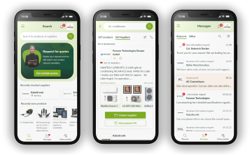
The europages app is here!

Use our improved supplier search or create inquiries on the go with the new europages app.

Download in the App Store

App StoreGoogle Play